
Mapping
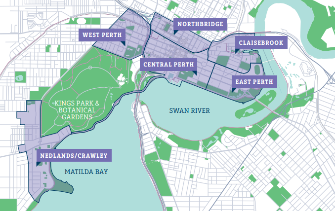
City of Perth boundary map
3D, Mapping and Data using Perth’s GeoHub
Perth’s GeoHub is our interactive site that provides information about property and locations within the City of Perth local government area. ArcGIS GeoHub is a web based collaborative platform hosted by ESRI that offers data accessibility and exploration while showcasing web maps, story maps and tools across ArcGIS Online. GeoHub will only display information that is already in the public domain, including:
- Property
- Aerial photography
- Car Parks
- City Planning Scheme
- Drainage
- Trees
How to use Perth’s GeoHub
There is a Get Started Guide available on the ArcGIS website for new users and those who need more assistance. Search by keyword or browse by category. Or click the magnifying glass to search and filter all content. GeoHub allows the use of different maps to display different types of information. If you are searching for information relating to a particular property, you have the ability to search for an address and information will appear instantly. New information is continually added, making it easy to access up-to-date information.
For additional information regarding the content of these maps, please contact the GIS Team at the City of Perth on (08) 9461 3654 or gis_support@cityofperth.wa.gov.au.
